What is a mesonet?
Mesonets are interconnected networks of automated weather stations installed across an entire state or region and are built to improve detection and monitoring of local or regional weather conditions.
Typically, each mesonet station will collect data on temperature, relative humidity, pressure, solar radiation, wind speed and direction, and precipitation at rapid intervals (every 3 to 60-seconds). Some stations include complementary measurements like soil conditions, snow cover, cloud cover, or cameras to view the surrounding conditions.
Many states have established independent mesonets, often managed by universities, in response to the need for precise, accurate, and timely weather information. To date, approximately 30 mesonets are established across the United States, filling coverage gaps in the federal weather observing network. .
State mesonets typically partner with NOAA to deliver data to the National Weather Service through the National Mesonet Program (https://nationalmesonet.us)
Indepth Weather Linegraph
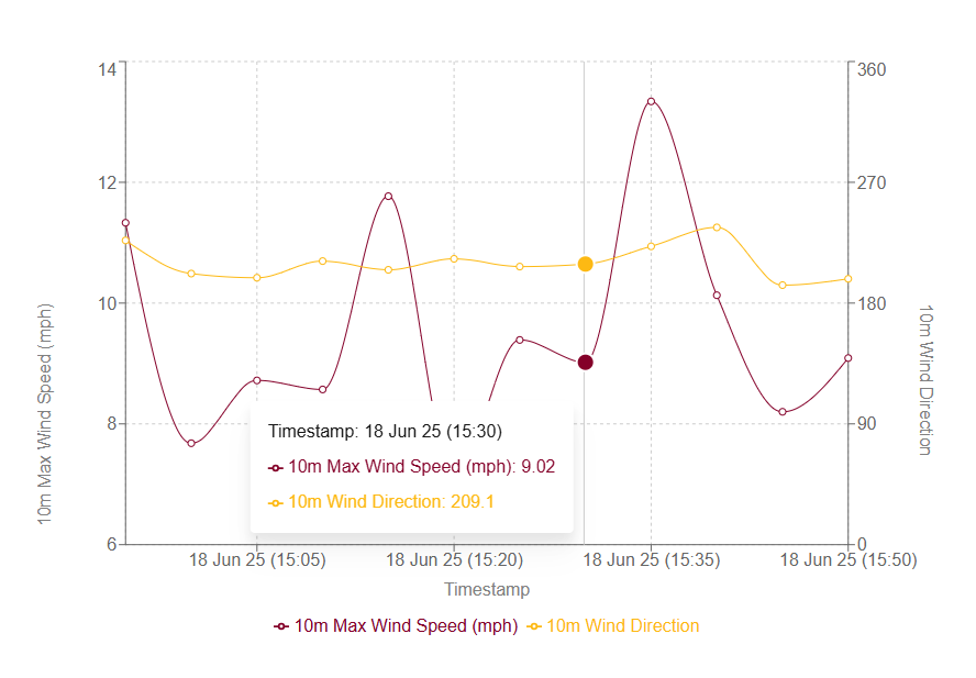
The Line Graph Menu lets you customize and visualize different types of environmental data—such as weather, soil, or battery readings—for a selected station in a clear and interactive line chart. Users can choose from various data categories and dynamically load related data types, such as temperature, wind speed, or soil moisture, depending on the selected category.
You can also configure the data range (e.g., past hour, day, or week) and the data interval (e.g., every 5 minutes to daily) to match your analysis needs. A maximum of two data types can be selected at once for comparison. This tool offers a flexible way to explore time-series data with precision and ease.

Heatmap Weather Overview
Explore weather conditions across Louisiana with our interactive state heatmap. This tool visually displays key metrics—such as 2m mean air temperature, daily high and low temperatures, dew point, and more—letting you easily monitor and compare data across regions. Each layer is color-coded for a clear, intuitive view of weather patterns.
Whether you're tracking temperature trends, monitoring storm impacts, or studying local climate variations, this tool offers valuable insights for both casual users and professionals. With up-to-date information presented in a user-friendly format, the Louisiana weather heatmap is a powerful resource for staying informed and making data-driven decisions.

Want to learn more?
Contact Us
